

The Planning Department conducts a comprehensive work program and shapes and influences growth and development in Westchester County in order to improve quality of life and protect the environment, resulting in more livable and sustainable communities.
Three of the five specialized sections of the department – Land Use and Development, Housing and Environmental Planning – focus on the initiatives that carry out this mission. They utilize the technical expertise of the department’s two other sections – Design and Administration – to produce quality products and plans in the most cost-effective manner for county residents.
Activities within each section focus on the pattern of development, the natural environment and ways in which buildings, transportation and open space can be shaped or utilized to achieve a physical environment that fosters smart growth for Westchester County. The department staff works closely with other county departments, elected and appointed officials and staff of the 45 municipalities and private and non-profit businesses and organizations.
The work program includes activities that are mandated by the county charter, New York State and the federal governments. These include the review of certain proposed land use and zoning actions by municipalities, review of county capital projects and the environmental review (SEQR or NEPA) of all county projects and legislative actions.
The mailing address for the planning department is:
Westchester County Department of Planning
148 Martine Avenue, Room 432
White Plains, NY 10601-4704
If you have questions about specific topics, research or reports, contact the individual referenced in the relevant pages, where you'll find the contact name, phone number and e-mail address.
| Main Office | (914) 995-4400 |
The Planning Department maintains a wide array of maps which can be viewed online or purchased in print. We are located on the 4th floor of the Michaelian Office Building at 148 Martine Ave. in White Plains. Go to directions. Our walk-in hours are from 9:00 a.m. to 4:00 p.m. on weekdays. For more information, contact Karen Duffy by e-mail at or call (914) 995-4418.
The Westchester County Clerk's office maintains an extensive online database of land records and maps. Go to online database.
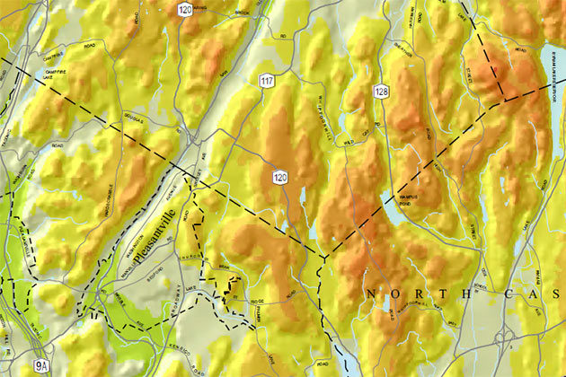
Many of the mapped features and other geographic data layers including recent aerial photography can be viewed and downloaded from Westchester County's GIS Web site. Unless noted, most printed maps are at a scale of 1"=1 mile.
| Planning and Land Use Maps | Price | |
| Municipalities and Place Names | $15.00 | |
| Parcel Based Land Use 2009 | $15.00 | |
| Municipal Zoning Composite 2014 | $15.00 | |
| Open Spaces 2006 | $15.00 | |
| Westchester County Inventory of Historic Places 2015 | online only | |
| Eligible Areas - Fair and Affordable Housing Implentation Program | online only | |
| Top Ten Municipalities in Housing Production by Decade 1960-2010 | online only | |
| North and South County Trailways on the former Putnam RR right-of-way | online only | |
| Sanitary Waste Disposal Method by Parcel 2009 (Croton - Kensico Watershed Municipalities) | online only | |
| Patterns for Westchester - County's Master Plan Map 1996, 1"=2 miles | online only |
| Transportation Maps | Price | |
| County and State Roads and Parks 2015 | $15.00 | |
| Traffic Volume 2006 | $15.00 |
| Facility and District Maps | Price | |
|
District 1, District 2, District 3, District 4, District 5, District 6, District 7, District 8, District 9, District 10, District 11, District 12, District 13, District 14, District 15, District 16, District 17 |
$15.00 | |
| United States Congressional Districts 2012 | $15.00 | |
| New York State Senate Districts 2012 | $15.00 | |
| New York State Assembly Districts 2012 | $15.00 | |
|
School Districts and Educational Facilities 1999 (public and private schools and colleges) |
$5.00 | |
| Postal Zip Code Areas and Facilities 1998 | $5.00 | |
| Westchester County Agricultural District 2014 | NA | |
| Houses of Worship 2015 | ||
| County Funded Youth Programs 2013 | NA |
| Environmental Maps | Price | |
| Topography (100’ interval) | $15.00 | |
| U.S.G.S. Topographic Quad Maps - color 1"=2000' | $5.00 | |
| Major Drainage Basins | $15.00 | |
|
Environmental Features 2014 (steep slopes, wetlands, hydrology, CEA, etc) |
$15.00 | |
| Natural Resource Inventory - links to PDF maps by municipality | online only | |
| Westchester County Sewer Districts and Facilities in 2000 (2015) | $15.00 | |
| Major Water Suppliers and Districts 2015 | $15.00 | |
| County Critical Environmental Areas (CEA) - adopted map from 1989, 1"=4000' | $5.00 | |
| Soil Survey Map Set 1"=1000' | $25.00 |
Maps that sell for $15.00 are individually printed on the department's color plotter. A few other maps (School Districts, Postal Zip Code Areas, e.g.) are offset printed in larger quantities and are sold at a lower price.
| Aerial Photographs | Price | |
|
Historical Aerial Photographs for the years 1995, 1990, 1986, 1980, 1976, 1970, 1965, 1960, 1954, 1947, 1940, 1926 and 1925 can be viewed online by clicking here. Our Aerial Photographic collection can also be viewed through a GIS mapping application that includes the years 1947, 1960, 1976, 2000, 2004, 2007, 2009, 2010, 2011 and 2013. Go to viewer. Use the slider at top right of map to select year to display. |
||