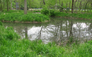
Wetland Management Plan
 A Wetland Field Assessment and Management Plan (Volume 2) for the Bronx River Watershed was completed as part of the 2007 Bronx River Watershed Management Plan. Volume 1 was the Stormwater Pollution Control Plan.
The specific objectives for achieving the goals of the Wetland Field Assessment and
Management Plan are:
- Ground truth wetland sites previously identified by existing wetland maps
- Identify unmapped wetland sites while in the field conducting groundtruthing activities
- Conduct a rapid and complete field assessment, including collecting information on the following parameters:
- soil
- hydrology
- vegetation
- surrounding land use
- wildlife habitat
- sources of degradation or impairment, and
- degree of functioning for:
- water quality maintenance and improvement
- surface water storage
- ground water storage
- fish habitat
- wildlife habitat
- erosion control
- recreation opportunities
- Create a user-friendly database containing all field data
- Prepare a Wetland Field Assessment and Management Plan that clearly and succinctly describes potential management measures for each wetland site.
| Wetland Field Assessment and Management Plan |
| Preface |
| 1 Introduction |
| 2 Methodology |
| 3 Wetland Assessment |
| 4 Management Recommendation Categories |
| Figures | |
| Figure 1 | Location of Bronx River Subwatersheds, Westchester County, New York |
| Figure 2 | Locations of Wetlands in the Municipalities of Harrison, Mount Pleasant, New Castle, and North Castle, Westchester County, New York |
| Figure 3 | Locations of Wetlands in the Municipalities of Ardsley, Elmsford, Greenburgh, Scarsdale, and White Plains, Westchester County, New York |
| Figure 4 | Locations of Wetlands in the Municipalities of Bronxville, Eastchester, Mount Vernon, Tuckahoe, and Yonkers, Westchester County, New York |
| Figure 5 | Schematic representation of management measures at an example site |